
RTK Positioning in Drones: Matrice 350 RTK for Precision Surveying
Precision matters in professional surveying, and no technology has done more to bring centimeter-level accuracy to aerial data collection than Real-Time Kinematic (RTK) positioning. The DJI Matrice 350 RTK has become the gold standard for survey-grade aerial platforms, combining RTK positioning with a robust airframe, extended endurance, and an ecosystem of mapping payloads that make it indispensable for surveyors, engineers, and geospatial professionals worldwide.
Understanding RTK: Why Centimeters Matter
Standard GPS positioning, as used in consumer drones, delivers accuracy of 1–5 meters — sufficient for photography but entirely inadequate for professional surveying, construction stakeout, or volumetric measurement. RTK technology eliminates this limitation by using a ground-based reference station (or NTRIP network correction) to provide real-time correction signals to the drone's GNSS receiver. The result is horizontal positioning accuracy of ±1 cm + 1 ppm and vertical accuracy of ±1.5 cm + 1 ppm — precise enough to replace traditional ground survey methods for most applications.
This accuracy directly translates to data quality. Photogrammetric maps produced with RTK-positioned images require fewer ground control points (GCPs), reducing field setup time by 60–80%. Volumetric calculations for stockpile measurement achieve ±1.5% accuracy compared to ±5–10% for standard GPS-positioned surveys. Construction progress monitoring detects grade deviations of as little as 2 centimeters, enabling early intervention before costly rework becomes necessary.
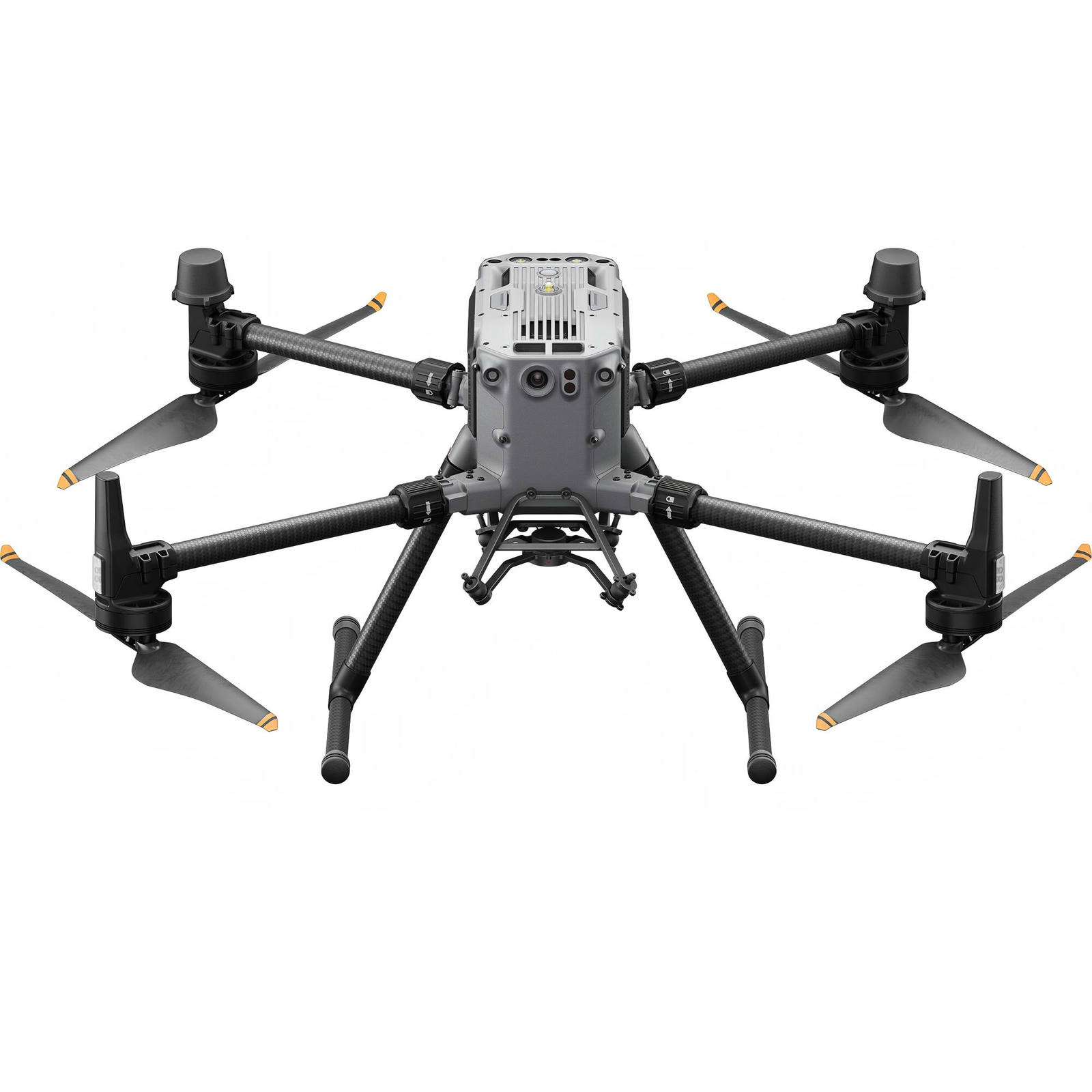
Matrice 350 RTK: The Complete Survey Platform
The Matrice 350 RTK builds upon the proven Matrice 300 series platform with significant upgrades across every dimension. Flight time extends to 55 minutes with the TB65 dual-battery system — the longest endurance of any DJI enterprise drone — enabling large-area mapping missions that previously required mid-mission battery swaps. The aircraft supports a maximum payload of 2.7 kg, accommodating the full range of DJI mapping payloads including the Zenmuse P1 (full-frame photogrammetry camera), Zenmuse L2 (LiDAR scanner), and Zenmuse H20 series (multi-sensor inspection payloads).
The RTK module receives corrections from the DJI D-RTK 2 High Precision GNSS Mobile Station or from NTRIP network services, supporting GPS, GLONASS, BeiDou, and Galileo satellite constellations simultaneously. The multi-constellation approach ensures reliable RTK fix even in partially obstructed environments where single-constellation receivers would lose accuracy.
Payload Spotlight: Zenmuse P1 and L2
The Zenmuse P1 pairs a 45MP full-frame sensor with a mechanical global shutter that eliminates rolling shutter distortion during high-speed flight — a critical requirement for accurate photogrammetric processing. Combined with RTK positioning, the P1 produces orthomosaics with ground sample distances (GSD) as fine as 1.5 cm at 100-meter altitude, sufficient for detailed engineering-grade mapping.
The Zenmuse L2 LiDAR scanner captures 240,000 points per second with 5 returns per pulse, penetrating vegetation canopy to map ground elevation beneath dense foliage — something photogrammetry alone cannot achieve. The integrated IMU and RTK receiver produce georeferenced point clouds directly, without the need for post-processing with ground control. This workflow reduces office processing time from hours to minutes and enables same-day delivery of survey deliverables.
Operational Resilience
The Matrice 350 RTK is built for daily professional use in demanding conditions. Its IP55 rating protects against rain and dust, the operational temperature range spans -20°C to 50°C, and the six-directional sensing system with active braking ensures safe operation near structures and terrain. Redundant flight systems — dual batteries, dual IMUs, dual compasses, and triple-redundant satellite receivers — provide the reliability that professional operations demand. Hot-swappable batteries allow continuous operation without powering down the aircraft, minimizing downtime between missions.
For surveying firms, engineering consultancies, and government mapping agencies seeking the definitive aerial survey platform, contact DJI-ELITE for Matrice 350 RTK pricing, payload configuration advice, and training program information for your team.